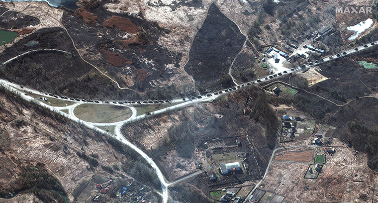
New satellite images from Maxar Technologies show the Russian military convoy that has reached the outskirts of Kyiv is even longer than it previously measured.
Maxar said late Monday the convoy is more than 40 miles long. Earlier Monday, Maxar said the convoy took up roughly 17 miles of roadway.
Maxar told CNN earlier Monday the large military convoy consisted of armored vehicles, tanks, towed artillery and other logistical vehicles.
Maxar attributed the updated convoy length to additional satellite imagery they collected and analyzed. Maxar said data and imagery taken Monday shows the convoy stretches from the Antonov airbase — about 17 miles from Kyiv’s city center — to just north of Pribyrsk, Ukraine.
To put a point on how far away Pribyrsk is from the Ukrainian capital, the small town is closer to the Ukraine-Belarus border and the failed nuclear reactor at Chernobyl than to Kyiv.
The company noted it saw plumes of smoke rising from a number of homes and buildings north and northwest of Ivankiv, near the roads where the convoy is traveling. At this time, it’s unclear what has caused the plumes of smoke.
According to Maxar, in some areas the roadways are so choked with military vehicles it’s actually causing traffic jams.
On Sunday, Maxar had measured the convoy — then near Ivankiv, Ukraine — at roughly 3.5 miles long.

