Linn Maung
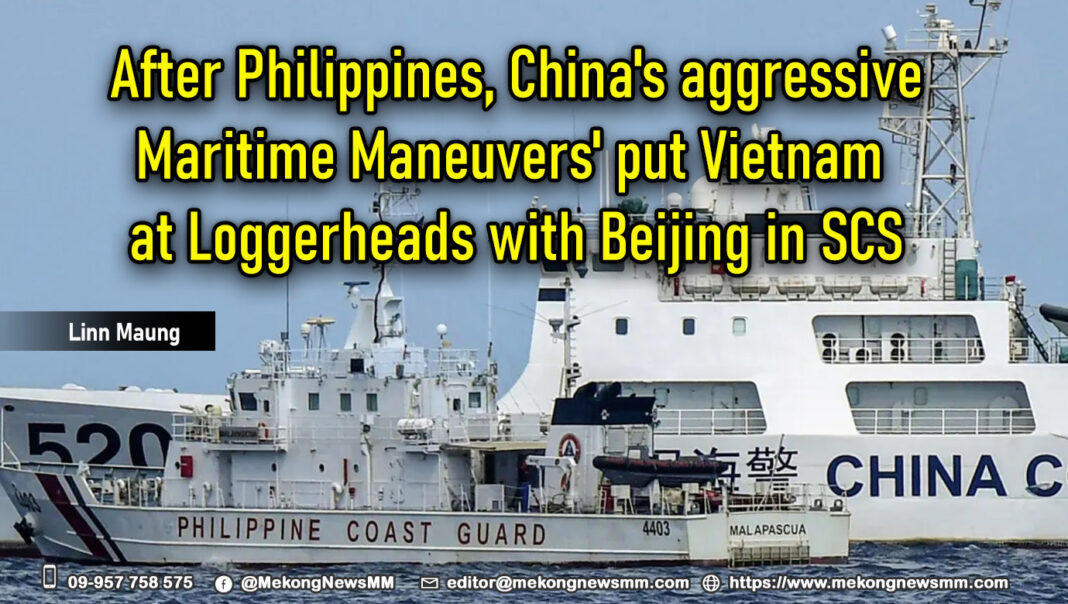
The escalating tensions between the Chinese Coast Guard and the Philippine forces have been capturing media attention. However, another nation in the South China Sea(scs) is feeling the brunt of Beijing’s assertive tactics. Vietnam has voiced its apprehensions about the heightened presence of Chinese research vessels in its maritime territory and has urged Beijing to put an end to its “ unlawful activities.”
In accordance with China’s maritime Gray zone strategies, there’s been a surge in the presence and persistence of Chinese vessels in Vietnam’s Exclusive Economic Zone (EEZ), escalating the pressure on Vietnam. In 2023, a Chinese survey ship undertook a month-long intrusion into Vietnam’s EEZ, which spans 200 nautical miles from its coastline. This friction between the two nations could potentially ignite another hotspot in the South China Sea.
Chinese research, coast guard, and civilian vessels have sustained their presence in these waters, disrupting Vietnamese oil and gas operations. On June 6, Vietnam voiced its concerns over the survey activities of the Hai Yang 26 vessel within its EEZ and continental shelf. Hanoi has conveyed its objection to the Chinese hostility through diplomatic channels.
Phạm Thu Hằng, a representative for the foreign ministry, voiced on June 6: “ Vietnam is profoundly disturbed and resolutely rejects, and demands China to halt the unauthorized survey activities of the Hai Yang 26 vessel within Vietnam’s exclusive economic zone and continental shelf, as defined by the United Nations Convention on the Law of the Sea (UNCLOS 1982).”
The extended stay of Chinese survey vessels in the region is an element of Beijing’s assertive maneuvers within its adjacent EEZ, laying claim to almost the whole South China Sea, an area rich in unexplored oil and natural gas reserves. The sea is estimated to hold 11 billion barrels of unexplored oil and 190 trillion cubic feet of natural gas.
The Hai Yang 26, a multi-functional research vessel, is managed by the China Geological Survey, a division of the Chinese Ministry of Natural Resources. With an endurance of 35 days, it boasts 32 geological survey equipment modules, encompassing drilling, static cone penetration, geophysical surveys, and mineral studies.
The onboard scientists have the capability to carry out exhaustive surveys of reefs and other offshore engineering project-related investigations. The electronic gear comprises single-beam and multi-beam echo sounders, an acoustic current Doppler profiler, and seismic data gathering tools.
Survey vessels are engineered to scrutinize underwater structures by emitting sound waves into the ocean and collecting underwater samples. As per the International Maritime Organization’s database, 64 Chinese survey vessels registered were constructed in or after 1990, exceeding the 44 in the US and 23 in Japan.
The survey activities of vessels registered to other countries can typically be identified by the vessel’s operator. For instance, in the United States, the U.S. Navy conducts military surveys, marine scientific research is undertaken by universities or civilian entities like the National Oceanic and Atmospheric Administration, and commercial surveys are performed by private firms.
In the vast expanse of the South China Sea, China’s state-owned fleet sails without clear demarcation of purpose. The fusion of civil and military operations in China suggests a high probability of data sharing among scientific, military, and commercial sectors. This data, gathered by Chinese survey vessels, fuels China’s aggressive pursuit of seabed mining. The South China Sea, a strategic waterway, offers a significant advantage for China’s subsurface operations, particularly for Autonomous Underwater Vehicles (AUVs).
The waters have also been a stage for geopolitical drama. In 2019, a week-long face-off between Chinese and Vietnamese coast guard vessels over a reef risked escalating into the most significant clash in half a decade. This confrontation echoed a similar standoff in 2014 when a Chinese oil rig made its way to the disputed Paracel Islands. Fast forward to 2023, tensions flared again as Vietnam sought to expand its oil drilling operations in Vanguard Bank, a territory claimed by both nations. This has led to a maritime chess game, with both countries dispatching ships to drive away the other’s vessels.
Satellite images reveal China’s land reclamation activities in the South China Sea, either by expanding existing islands or creating new ones. This is achieved by depositing sand onto reefs, leading to the construction of ports, military facilities, and airstrips, especially on the Paracel and Spratly Islands. Woody Island has been militarized with the deployment of fighter jets, cruise missiles, and a radar system.
These surveys, while ostensibly scientific, yield seabed data serving dual civilian and military uses. Seismic data is vital for geological assessments, but the presence of hydrocarbons, water, and seabed conditions also influence submarine detection. Research vessels, while conducting scientific research, can employ their instruments for naval reconnaissance, collecting intelligence on foreign military installations and vessels nearby.
Analyzing regional seasonal deployment patterns enables China to enhance its submarine operations. Knowledge of maximum depths assists in conceptualizing mine warfare scenarios. Constant wind data collection provides insights into take-off and landing prerequisites for both adversary jets and China’s regional airpower. This capability is crucial as the US naval force and its allies navigate the South China Sea to uphold international waterway freedom.
mekongnewsmm.com

